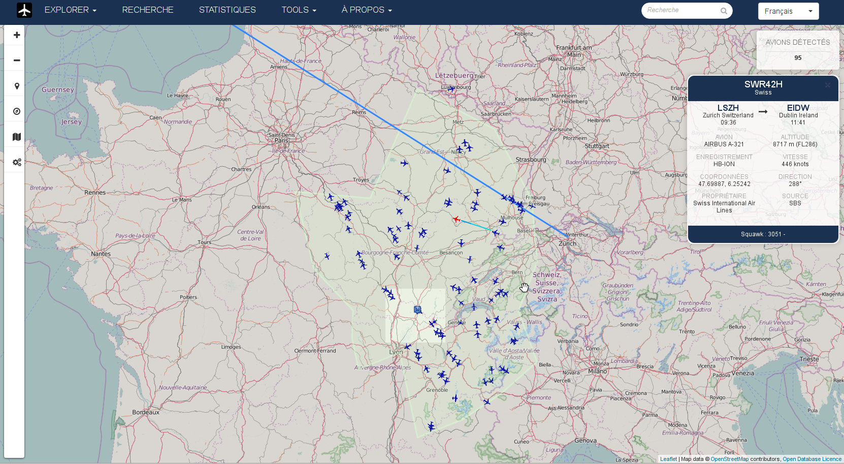
Welcome to FlightAirMap
Display flights on map
Real or virtual flights are displayed in real-time on a 2D or 3D map. Airports are also available on map. Statistics for pilots and/or owners are generated.
Display vessels on map
Real Vessels or virtual sails are displayed in real-time on a 2D or 3D map.
Display trackers on map
Trackers are displayed in real-time on a 2D or 3D map. Track trucks, cars, smartphones,...
Display satellites on map
Satellites and space stations are displayed in real-time on a 2D or 3D map.
2D and 3D map
3D models for flights, vessels, car, trucks, satellites,... are available for 3D map.
Many map layers can be used : OpenStreetMap, Mapbox, Google Map, Bing, Yandex,...
Free & Open Source
FlightAirMap is available under GNU Lesser General Public License 3 (LGPL3).
Commercial license available.
An application with many features
FlightAirMap includes:
- Statistics for airlines, aircrafts, airports,...
- Schedules informations for real flights
- ACARS messages support
- Aircraft accidents and incidents
- Archive of old flights, vessels or/and trackers (trucks, cars, smartphones,...)
- METAR and NOTAM support
- Many sources can be used : ADS-B, VRS, VATSIM, IVAO, phpVMS, Glidernet,AIS, APRS,Sailaway,...
- 3D map using CesiumJS
- Satellite tracking on 2D and 3D map
- Several sources can be used at the same time
- Map matching for trackers
- Display elevation using the Shuttle Radar Topography Mission (SRTM)
- Support MySQL/MariaDB and PostgreSQL as DB
- Multi-language support (english and french for now)
FlightAirMap is a free and Open Source PHP application displaying flights, vessels and/or trackers on a map from source of your choice.

News
Better Acarsdec and VDML2dec support, update to Cesium 1.43 with Cesium World Terrain 7.3.2018 09:53
FlightAirMap now support Acarsdec and VDML2dec JSON format.

Cesium is updated to 1.43 and Cesium World Terrain support is added.

Ocean surface and wind 8.12.2017 14:41
Winds can be displayed on FlightAirmap 2D mode

Ocean surface currents can also be displayed in 2D mode

Clouds in 3D view 14.11.2017 16:55
You can now see clouds in FlightAirMap. This use METAR from the closest airports to get local real weather.


Archive mode, great circle, list and real time data update 10.11.2017 19:34
A dirty archive mode is available in 2D and 3D mode.

Route to airport destination now follow great circle.
 All flights, trackers, marine are available in a list at the bottom of the map. Data in infobox is updated in real time.

XCSoar TSK, 2.5D buildings on 2D map, offline support and map matching support 29.9.2017 12:16
XCSoar TSK files support.

2.5D buildings support on 2D map.

Offline support. No need to have Internet to use FlightAirMap.

Map matching for tracker mode, with own FlightAirMap Map Matching server or graphhopper, OSMR and Mapbox support.


